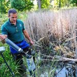
 Heavy urban development has caused excess stormwater runoff in the Cleveland area. As a result, the city’s metroparks can experience flash floods, which damage aquatic habitat, erode river banks, and carry sediment into Lake Erie.
This increased stormwater runoff has had a number of undesirable effects on the parks system and overall watershed health. Under normal circumstances, headwaters moderate flow from heavy rains, process nutrients, and reduce sediment. They also provide habitat for unique native flora and fauna in the water and in surrounding riparian habitats. With heavier runoff, however, they are subject to channelization, culverting, and pollution. Additionally, stream bed scouring destroys the habitat used by many native species.
In the interest of better understanding the impacts of the stormwater, Cleveland Metroparks began a study of vulnerable headwater streams. As a second component to the research, Metroparks ecologists aim to gauge how effective small wetlands are at assisting with water removal and at improving water quality.
What makes this study unique compared to others is its use of real-time flow and water quality monitoring systems to provide short-interval hydrograph and water quality data. Instead of the daily or monthly samples and level measurements used in existing research, the continuous monitoring network provides data every 15 minutes.
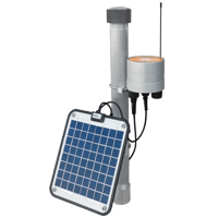
Cleveland Metroparks worked with NexSens to install the real-time flow and water quality monitoring stations, which utilize NexSens data logging and telemetry technology.
Hydrology through the metroparks
 Isco 2150 Area Velocity Flow Meters monitor precise water flow data at six primary headwater streams with similar geology, catchment size, fall, and channel width but of varying hydrologic intactness. The sites include two moderately degraded, two severely degraded, and two reference streams.
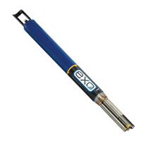
Additionally, four water quality and quantity monitoring stations are installed throughout wetlands in the 2,600-acre Rocky River Reservation, with three sites at inlet locations and one at the outlet. Two more sites are located at wetland outflows in West Creek Preserve, a 500-acre park. Each of these sites is equipped with an Isco flow meter and a YSI multi-parameter sonde with temperature, pH, conductivity, ORP, dissolved oxygen, and turbidity probes.
Sensors connect to NexSens iSIC data loggers, which are equipped with real-time cellular telemetry. A computer running NexSens iChart software receives and processes measurements from the data loggers.
By comparing the inlet and outlet data, the research team is able to quantify the wetlands’ exact levels of water storage and effectiveness at reducing pollutants.
“With the flow meters, we’re getting actual quantities of water. That level of detail allows us to find stuff that we couldn’t before,” said John Mack, Metroparks’ chief of natural resources. “We sometimes don’t know what we’re going to find, because no one has ever been able to collect this kind of data.”
The stations are part of a pilot project for monitoring larger watershed restoration projects, Mack said. He said he hopes to eventually conduct urban watershed restorations using the short-interval data to assess their progress.
The NexSens X2 Environmental Data Logger offers the latest in real-time monitoring technology with wireless communication, large plug-and-play sensor library, and ultra-low power consumption.
The YSI EXO represents the next generation of water quality instruments from YSI. The EXO1 sonde includes four sensor ports with internal data logging and battery power.
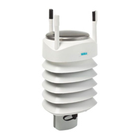
The Vaisala WXT536 Multi-Parameter Weather Sensor simultaneously measures air temperature, humidity, pressure, rainfall and wind in a compact platform with optional heating.


