 Hydraulic fracturing, or “fracking,” has been grabbing more headlines in recent years, as use of the controversial drilling technique has significantly expanded in order to increase natural gas production. The process involves injecting millions of gallons of water, sand, and numerous chemicals deep underground in order to fracture rock formations and release the gas deposits they contain.
It makes accessing natural gas deposits thousands of feet underground economical, but it is associated with numerous environmental concerns.
The Marcellus Shale extends throughout much of the Appalachian Basin, including the Susquehanna River Basin. This sedimentary rock holds significant natural gas reserves, and a recent boom in drilling has jeopardized water quality of the region. A monitoring system for the Susquehanna River itself has already been in place for some time. However, the Susquehanna River Basin Commission proposed a more comprehensive water quality monitoring network in 2009 as scrutiny mounted over water conditions resulting from drilling.
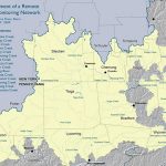
The SRBC has now installed more than 40 remote water quality monitoring stations in the river basin, including the border between Pennsylvania and New York where gas drilling is most active. These stations form a network that wirelessly transmits water quality data in real time to the SRBC website.
Water quality data may be viewed by officials, scientists, and the public to keep tabs on their local rivers and streams for the threat of natural gas pollution as well as any other irregularities in the water. NexSens Technology has provided the data logging and remote telemetry solution for several systems.
Watching water during drilling operations
 The first phase of installation, which started in early 2010, added 30 remote water quality monitoring stations in the northwestern part of the basin. Additionally, some stations were placed in areas where no drilling activities were planned, providing needed control data. At the end of the year, work began to expand the network with 25 additional stations, ten of them being placed within New York’s portion of the shale.
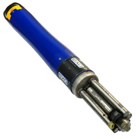
Water data is monitored using YSI multi-parameter sondes. Measured parameters include water temperature, conductivity, pH, dissolved oxygen, and turbidity.
Conductivity is of particular interest, as it correlates with natural gas activity. Water containing spilled fracking fluid typically shows conductivity levels 200 times greater than normal measurements, according to the SRBC, because of the brine solution used. This makes conductivity a significant indicator of pollution from drilling activities.
Each sonde also includes a built-in depth sensor to monitor volume of water flow. All data measured by the sondes is collected by the water quality monitoring stations located at various sites along the Susquehanna Basin.
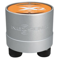
Each water quality monitoring station includes a NexSens data logger. The iSIC data logger (obsolete) features a built-in cellular modem, allowing it to transfer data to the project computer over the Internet using a cellular data plan. Another datalogger uses Iridium satellite telemetry, making it suitable for areas in the network that have little or no cellular reception. All stations are linked to a single, powerful network that provides vital information about the impacts of natural gas drilling and other threats to the quality of water in the region.
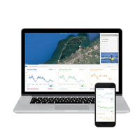
Data is sent to a computer running iChart software. The software interprets all incoming data and posts to the Web in real time. In addition to being able to view data from any Internet browser, the software allows the data to be processed into statistical summaries, graphs, and data tables for easy analysis of water quality status.
The NexSens X2 Environmental Data Logger offers the latest in real-time monitoring technology with wireless communication, large plug-and-play sensor library, and ultra-low power consumption.
The YSI EXO represents the next generation of water quality instruments from YSI. The EXO2 sonde includes six sensor ports and a central anti-fouling wiper option.
WQData LIVE is a web-based project management service that allows users 24/7 instant access to data collected from remote telemetry systems.


