The best data buoy in the world is in jeopardy if it breaks free of its mooring, and nothing is worth jeopardizing your crew. In this post, we discuss data buoy deployment, including deploying a data buoy safely, each time from the start. We offer some helpful tips about the structure and function of data buoys that affect safe deployment.
Data Buoy Deployment: Ballast Weight and Stability
To prevent overturning of a NexSens data buoy system, it must be deployed to ensure that it remains stable in the water. What it means to hold a data buoy stable changes depending on the local weather conditions and instrumentation. A minimum ballast weight of 100 pounds (for CB-650 model and higher) is recommended even in calm waters to ensure that a data buoy remains stable, and more is needed for deployment locations with rougher waters.
It may seem odd that a data buoy would need ballast; doesn’t this mean it’s badly designed? Not at all. Whether or not a data buoy needs ballast, or how much it requires, is determined by the buoy’s center of gravity, the deployment conditions, and how much extra weight the buoy is carrying. The buoy’s center of gravity is close to the surface of the water when instruments are not connected to it. Each time instruments are added above the water surface ballast must also be applied below to avoid an unbalanced, unstable buoy. In other words, the ability to adjust stability and weight with ballast is a feature of the customizable data buoy.
Of course, basic physics also plays a part in how much stabilizing effect any ballast will have on a data buoy. Ballast—and instrumentation—added further from the center of gravity has a greater impact on stability. One method for mitigating against this issue is using an instrument cage.
By mounting an instrument cage to the frame of the data buoy, you achieve a deeper physical mounting location for instruments, and the extra weight they bring. This, in turn, disrupts the data buoy’s stability less, while the weight from the mooring lines and chain connected to the bottom of the cage add further natural ballast for buoys with single-point mooring configurations.
Remember, experiment and test balance and stability first before deploying your data buoy. In many, if not most cases the buoy will be well-balanced to start with, but depending on the unique conditions of your deployment, you may need to test and tweak to get your system as stable as you’d like it to be. Remember to add chain to the bottom of your buoy system as needed, and take steps to ensure you don’t ruin your buoy’s sensitive data well, which is not rated for submersion and can be jeopardized by bad weather. It is also important to use sacrificial zinc anodes whenever deploying a buoy in a saltwater environment. This helps prevent corrosion, although you must regularly inspect and replace anodes.
Mooring Configurations for Deploying a Data Buoy Safely
In reality, the different potential mooring configurations for a safe deployment vary considerably. Criteria for deciding which mooring options and strategies are best depend heavily on your particular application. For this reason, it is essential to review all of your debris loads, wave action and currents, fluctuations in the water level, and other application-specific criteria before deployment.
It is possible to deploy data buoys with single-point moorings in many locations with calm waters. The applications that work well with single-point moorings including those that deploy monitoring sensors in pipes or attached to instrument cages. This is because single-point moorings are less stable, potentially opening up instrumentation to more damage. Applications with sensors in pipes or cages are less vulnerable to damage caused by high currents, subsurface debris, and anchor line entanglement.
To safely execute a single-point configuration, an anchor and bottom chain link the buoy to the bottom via a stainless steel mooring line. Most of the bottom chain should be at rest on the bottom during normal times, with the mooring line taut. With higher water levels, the bottom chain ascends from the seafloor and the buoy rises.
For some applications, there is no way to protect the sensors as much. For example, there may be need to deploy monitoring sensors throughout the water column beneath the buoy. In these situations, two-point moorings are typically a good choice.
In most two-point configurations, the two mooring lines open up the water column for a suspended sensor line as they pull taut away from the buoy. Small marine marker floats connect the data buoy and the mooring lines, often on or near the surface of the water. These marker floats, of course, are connected to anchor and bottom chain assemblies and mooring lines that run to the floor, and it’s possible to add subsurface marker floats if necessary for certain applications. Just as the bottom chain in single-point systems keeps the buoy from submerging as the water level fluctuates, it serves the same purpose in the two-point system.
Safe Deployment of Data Buoys: The Bottom Line
As always, when deploying a data buoy or any other equipment, personnel safety is the number one priority. Any work on or near water and in weather is potentially hazardous, and even smaller buoy systems are heavy, carrying the risk of entanglement with anchors and mooring lines for personnel. Proper equipment is critical to any safe data buoy deployment, including flotation gear, gloves, lifting rig, safety footwear and other gear, and a workboat.
Remember, too, that before ever deploying a data buoy system, it is important to perform a complete system test. Run this thorough check onshore, because it is far easier to solve problems and troubleshoot in the lab than it is in the field.
For more advice and information on the safe deployment of data buoy platforms, check the NexSens online Knowledge Base.
Equipment
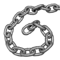
Galvanized chain is used to construct mooring lines for buoy-based water quality applications requiring single or multi-point moorings.
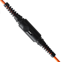
The NexSens TS210 Thermistor String provides high precision temperature measurements for profiling in lakes, streams, and coastal waters.
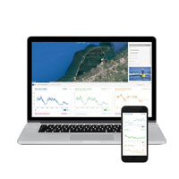
WQData LIVE is a web-based project management service that allows users 24/7 instant access to data collected from remote telemetry systems.


