The U.S. Army Corps of Engineers’ Huntington District (LRH) oversees various water quality and sediment monitoring programs across Kentucky, Ohio, Virginia, and West Virginia. The LRH covers approximately 45,000 square miles of drainage area, with nine river basins flowing into a 311-mile stretch of the Ohio River. The LRH monitors 35 flood control projects in […]
Articles Tagged: Ohio River
Measuring Dissolved Oxygen For Hydropower
American Municipal Power
An energy company has gathered comprehensive water quality data before and after adding a hydropower station at the Smithland Locks & Dam on the Ohio River.
Baseline Dissolved Oxygen Levels
American Municipal Power
An electric utility company monitors water quality at a new hydroelectric facility using the Ohio River to provide clean energy to the surrounding area.
Predictive E.coli Modeling
Regional Science Consortium
The Regional Science Consortium provides weather and water quality data to collaborators at Lake Erie and the upper Ohio River Basin.
H2S Gas Monitoring in Ohio Reservoirs
U S Army Corps of Engineers
In spring 2003, NexSens applications engineers installed H2S gas monitoring systems with real-time radio telemetry at 5 reservoirs.
Ohio River Data Buoy
ORSANCO
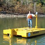
The Ohio River Valley Water Sanitation Commission has launched an Ohio River data buoy called the AMI (Advanced Measurement Initiative Buoy)
Drinking Water Early Warning System
Ohio River Valley Water Sanitation Commission
ORSANCO created a system that combines human and automated efforts to establish effective water quality monitoring programs on the rivers.
Real-Time Rainfall and River Water Quality Data
Edge of Appalachia Preserve
To document long-term trends in water quality and rainfall on the preserve, a monitoring system was installed that allows real-time collection of data.


