Water Current Monitoring

Nearshore fisheries, ports, search and rescue crews, climate researchers, and dredge or construction operators can benefit from water current data. Currents are typically measured with acoustic Doppler current profiler (ADCP) instruments. While often deployed as standalone loggers, real-time monitoring can detect changes, patterns and extreme conditions and provide notice when critical values are exceeded.
Water Currents

Typical Water Current System
Acoustic Doppler current profilers employ the principle of Doppler shift by calculating the difference in time between the sent and the received signal. These complex instruments can take either point measurements or horizontal or vertical profiles.
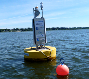
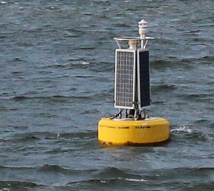
NexSens water current monitoring systems integrate ADCPs with automatic data transmission for near real-time current data. A typical system consists of a large buoy platform such as the CB-1250, which offers increased flotation and solar charging for heavy or power-hungry sensors while still maintaining a relatively small footprint. Specialized mounting brackets are available for mounting of some of the most common ADCP models including the Nortek Aquadopp and Signature series.
The CB-1250 supports the X3 environmental data logger for secure sensor connection in tough environments. Data transfer via radio, cellular or Iridium satellite telemetry to the WQData LIVE web datacenter provides options for data management and configuration of alarm notifications.
The X3 has multiple sensor ports, and with the large capacity of the CB-1250 buoy, systems can be expanded with a multitude of topside and subsurface sensors including weather sensors and multiparameter water quality sondes. Buoys also support mounting of an M650H solar marine light for nighttime visibility.
Contact a NexSens Applications Engineer today to discuss your current monitoring application.

Case Studies
Tracking Flow For Hydropower
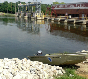
The Northern Indiana Public Service Company (NIPSCO) is a large energy provider in the state of Indiana. It provides power to more than a million customers through distributing energy derived from natural gas and hydropower dams. As part of achieving its mission to provide reliable energy to its customers, officials at the company have to be aware of changing flow rates near its hydropower assets. The real-time calculations are necessary for keeping plant managers up to speed on factors that could influence hydropower output.
Read MoreMichigan’s Muskegon Lake Sentinel
In 1985, Muskegon Lake was designated an Area of Concern by the U.S. EPA because of water quality and habitat problems associated with pollution discharged into its waters. The water body, which sits between the eastern shore of Lake Michigan and the Muskegon River, has been the site of remediation work ever since. In line with work to bring the lake back from its status as an Area of Concern, scientists at Grand Valley State University launched a massive data-collection system in spring 2011. Comprised of two buoys and dozens of sensors to measure the lake’s health, the system is cluing researchers in to Muskegon Lake’s dynamics like never before.
Read MoreGreat Lakes Buoy Networks
The Great Lakes region is a dynamic ecosystem that supports millions of people, plants and animals. Key to maintaining its vitality is making sure the waterways that sit at its base remain clean and healthy. To do that, scientists and water managers need steady, reliable data. They often get this information from buoy networks. There are many different Great Lakes buoy networks out there, which are largely supported by government agencies and universities. Maintaining these networks, including servicing old buoys or launching new ones, is a big and important job.
Read More


