 Monitoring efforts in Morro Bay have been ongoing for decades, studying the inputs of the bay’s tributaries, the outputs of the bay, and water quality conditions over time. For the past 18 years, California Polytechnic State University, San Luis Obispo (Cal Poly, SLO) has managed various monitoring stations in the bay and estuary.
The project started in 2006 as a Packard Foundation-funded initiative to monitor water quality flowing in and out of Morro Bay. At the time, the goal was to collect data in the estuary to develop and inform an ecosystem-based management plan in collaboration with the Morro Bay National Estuary Program (MBNEP).
A stationary monitoring system was installed in both Chorro Creek and Los Osos Creek. Eventually, a third station was installed in the southern end of the bay referred to as Bay South 1 (BS1). Then, a fourth station was deployed near the mouth of the estuary, appropriately named Bay Mouth 1 (BM1).
Funding for the MBNEP project concluded in 2011, and the two creek stations were closed. In 2012, Cal Poly received funding through the Central & Northern California Ocean Observing System (CeNCOOS) to keep the BM1 site running.
Local interest from two shellfish aquaculture facilities in the southern bay in addition to the California Department of Public Health helped to foster more funding from CeNCOOS, which allowed for the BS1 site to reopen in 2018.
 Challenge: Designing Monitoring Systems for Morro Bay
With new funding and a more focused network of systems, one of the first tasks Ian Robbins, Senior Research Scientist at Cal Poly, worked on was updating the equipment. Years of deployment in the salty estuary and bay had damaged the equipment at the BM1 and BS1 sites, impacting the reliability of the stations and consistency of data.
Since so many stakeholders were relying on the data, quality instrumentation that would work in marine environments was the primary consideration when designing the new stations.
Solution: Real-Time Data Collection and Robust Sensors
Both BS1 and BM1 were upgraded with a Sea-bird HydroCAT, SeaFET, and NexSens data logger. BS1 was also equipped with a Gill multiparameter weather station. The HydroCAT monitors salinity, temperature, pressure/depth, oxygen, backscatter, and chlorophyll; and the SeaFET sensor measures pH.
The sensor instruments are deployed on a plate that can be raised for maintenance and then lowered back into the water for data collection. The data logger is deployed well above the waterline in order to avoid any saltwater exposure.
Benefits: Easy Integration and Real-time Data Viewing
With so many stakeholders invested in the data collected by the stations, real-time data access was also an important factor in designing the systems.
 “NexSens became one of the only platforms that we could find that was an all-inclusive data integration platform, data transmission platform, and data viewing platform, that allowed us to connect all of our instruments and be able to display and look at and download that data,” recalls Robbins.
Because Cal Poly has been monitoring Morro Bay for so many years, there is a historical data pool for researchers and stakeholders to reference when creating ecosystem-driven plans or studying specific phenomena in the bay.
One example Robbins shares is the sudden loss and then regrowth of eelgrass, which is one of the major research focuses of the project’s principal investigators, Cal Poly Physics Professor Ryan Walter and Chemistry Associate Professor Emily Bockmon.
The historical data allow researchers like Walter and Bockman to examine conditions in the bay before, during, and after the eel grass die-off and subsequent regrowth.
The Bottom Line
Ultimately, Robbins explains that one of the main draws of having these instruments in the bay is to understand in real time what is going on in the water and try to come up with hypotheses or a better understanding of Morro Bay’s history.
Equipment
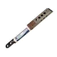
The Sea-Bird Scientific HydroCAT CTD is ideally suited for extended deployments in remote, biologically rich environments.
The NexSens X2 Environmental Data Logger offers the latest in real-time monitoring technology with wireless communication, large plug-and-play sensor library, and ultra-low power consumption.
The MaxiMet Marine Compact Sensors combine IP68 environmental protection with high quality sensors for deployment on data buoys and in other marine environments.


