 When the Okeechobee and the Caloosahatchee River were connected by the United States Army Corps of Engineers (USACE) in the 1880s, the region underwent a variety of environmental changes. While water control locks were installed in the 1930s and 1960s, the Sanibel area in Southwest Florida still suffered from deteriorating water quality due to runoff and pollution occurring up the river and surrounding watershed.
Incoming nutrient loading caused massive algae drift/stranding events in 2005-2006, according to AJ Martignette, the Laboratory Manager with Sanibel-Captiva Conservation Foundation (SCCF). The water quality shifts also led to the increased frequency and severity of red tides as well as large salinity swings affecting sea grasses in the estuary and freshwater grasses in the river.
In order to mitigate some of the damages, the SCCF stepped in to help develop a monitoring program that would help inform the USACE and the South Florida Water Management District when to release water and when to close off the connection between the lake and river. In 2007, what is now referred to as the River, Estuary and Coastal Observing Network, or simply RECON was created. Made up of 11 monitoring sites, the network tracks weather and water quality across Southwest Florida in order to ensure the residents can continue to rely on the aquatic system.
Challenge: Environmental Conditions in Southwest Florida
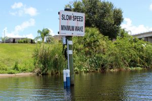 The primary challenge in creating this network was designing systems that were durable enough to withstand marine conditions. Flooding, waves and saltwater corrosion were all important variables to consider when selecting equipment to build the systems, according to Martignette.
In addition to being able to withstand marine, river and estuarine conditions, the data gathered by the system needed to be continuous and available in real-time to help inform decisions for the USACE-managed system. In order to make the most data-informed decision possible, the network gathers a variety of different measurements.
Solution: Rugged and Real-Time Data Logging
Already familiar with NexSens Technology and the X2 data logger due to using them for previous projects, Martignette was familiar with the real-time monitoring potential of the equipment. To meet the needs of the marine environment specifically, an X2-SDLMC provided the ruggedness needed for the more extreme application, all while maintaining the data logging capabilities of the X2.
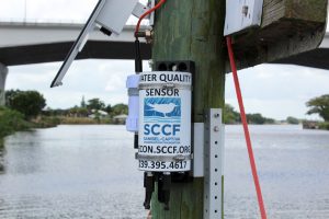
Pole-mounted systems can be found throughout the Sanibel area, all of which rely on the X2-SDLMC for logging and transmitting data to the cloud. The PVC housing of the X2-SDLMC protects the logger from corroding under the brunt of saltwater and from being damaged if submerged. The logger compiles data gathered by the sensors deployed at each station, which commonly include weather sensors a Seabird Scientific HydroCAT CTD and ECO Triplet flourometer, and transfers the compiled data to WQData LIVE.
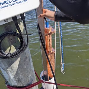 In terms of water, the SCCF is most interested in measuring water temperature, conductivity, salinity, Fluorescent Dissolved Organic Matter, chlorophyll, dissolved oxygen, sensor depth and turbidity. For weather, the systems assess air temperature, humidity, barometric pressure, wind speed, wind direction, wind gust, daily rain and yearly rain.
Benefits: Long-Term Monitoring and Data Accessibility
The real-time monitoring capabilities of the X2 data logger allow the SCCF to track conditions in the bay and communicate concerns to the USACE. The durable design of the X2-SDLMC allows for continual data collection, standing up to various environmental conditions.
RECON is used scientists at SCCF’s Marine Lab along with dozens of external collaborating scientists for specific projects across Sanibel Island, the Caloosahatchee Estuary and other freshwater sampling sites in southwest Florida—all of them rely on the systems continuously collecting data to study changing conditions in the region. With such a large group of researchers reliant on the data, WQData LIVE makes data-sharing easy and simple.
The loggers also feed data to the publicly available SCCF site map, helping to inform the public of current environmental conditions. Data can also be easily shared with USACE managers, allowing them to observe conditions downstream and open or close the connection and mitigate worsening conditions.
The Bottom Line
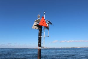 Since the network’s inception in 2007, RECON has been widely popular with the public and helpful for environmental scientists in the Caloosahatchee River and Estuary area. The simplicity and accessibility of the X2 is what drew the SCCF to NexSens when the network was created with real-time in mind. Compared to other loggers on the market, the X2 comes pre-programmed for remote monitoring.
“Real time is the key nowadays. I mean, it’s almost silly, I think, to put up sensors in this day and age that there aren’t real time, and so it’s what we do. And the great thing about the NexSens versus our old system is a complete package. [. . .] This is just simple plug and play. You put it out there and it works,” explains Martignette.
Equipment
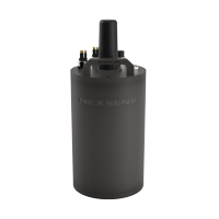
The X2-SDLMC is a rugged, self-powered remote data logging and telemetry system specifically designed for offshore use without fear of accidental flooding.
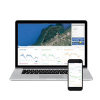
WQData LIVE is a web-based project management service that allows users 24/7 instant access to data collected from remote telemetry systems.
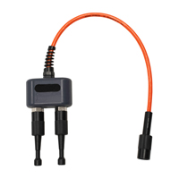
The 2-way wet-mate sensor splitter expands the number of sensor ports on an X2-CBMC or X2-SDLMC data logger.
The Sea-Bird Scientific HydroCAT CTD is ideally suited for extended deployments in remote, biologically rich environments.
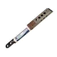
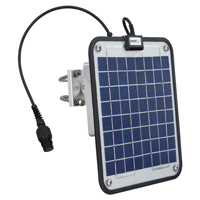
The SP-Series Solar Power Packs feature a solar panel, regulator, and battery housed in a weather tight enclosure.

