

How to Measure Ocean Currents Using a NexSens Buoy
Recommended Water Current Monitoring System
Data buoys provide a convenient method to deploy Doppler current profilers in any open-water application. Turnkey systems facilitate setup and deployment, making it as simple as possible to remotely acquire data from this advanced instrumentation.
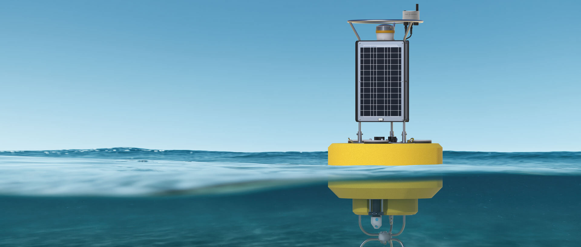
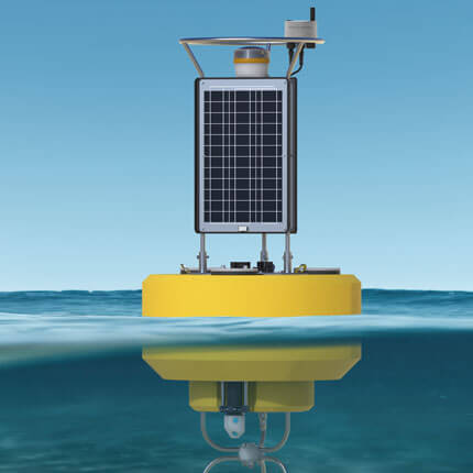
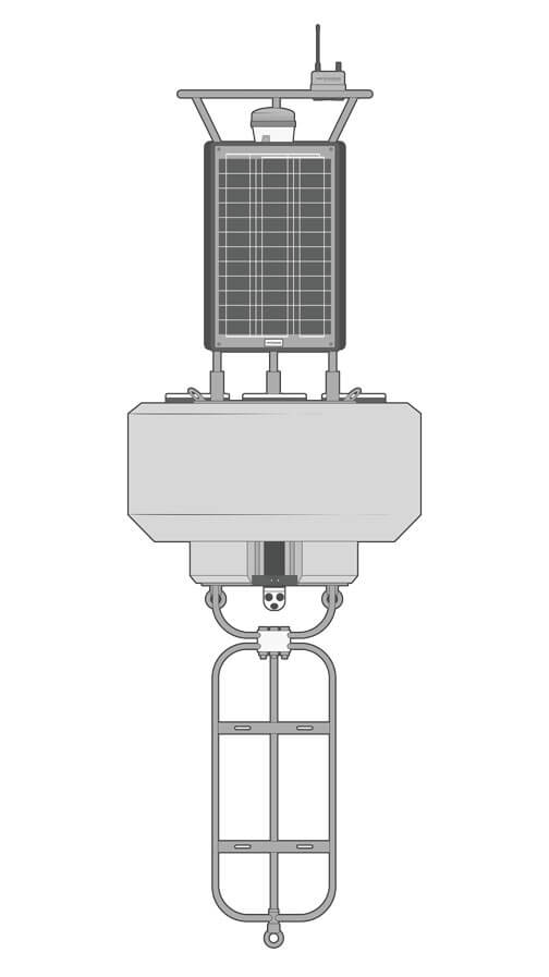
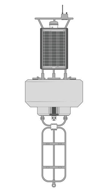
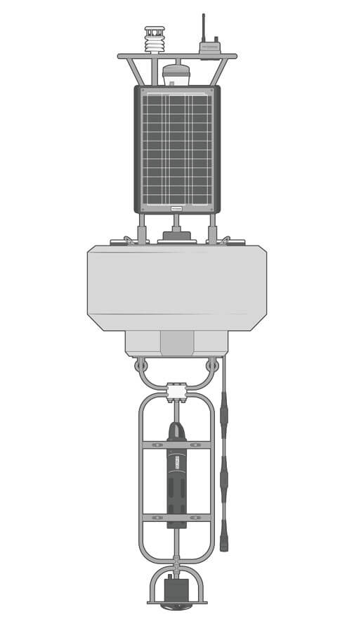
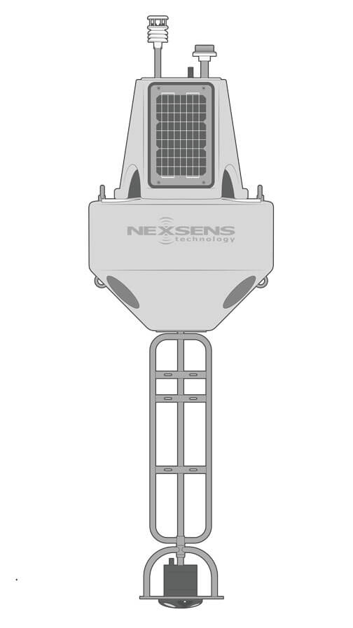
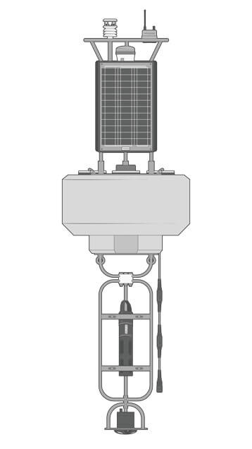
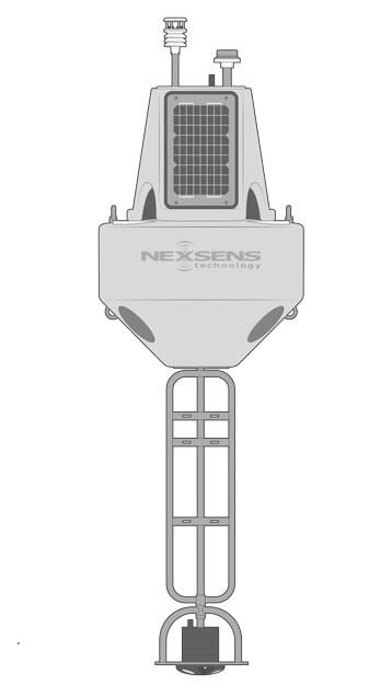
Buoy
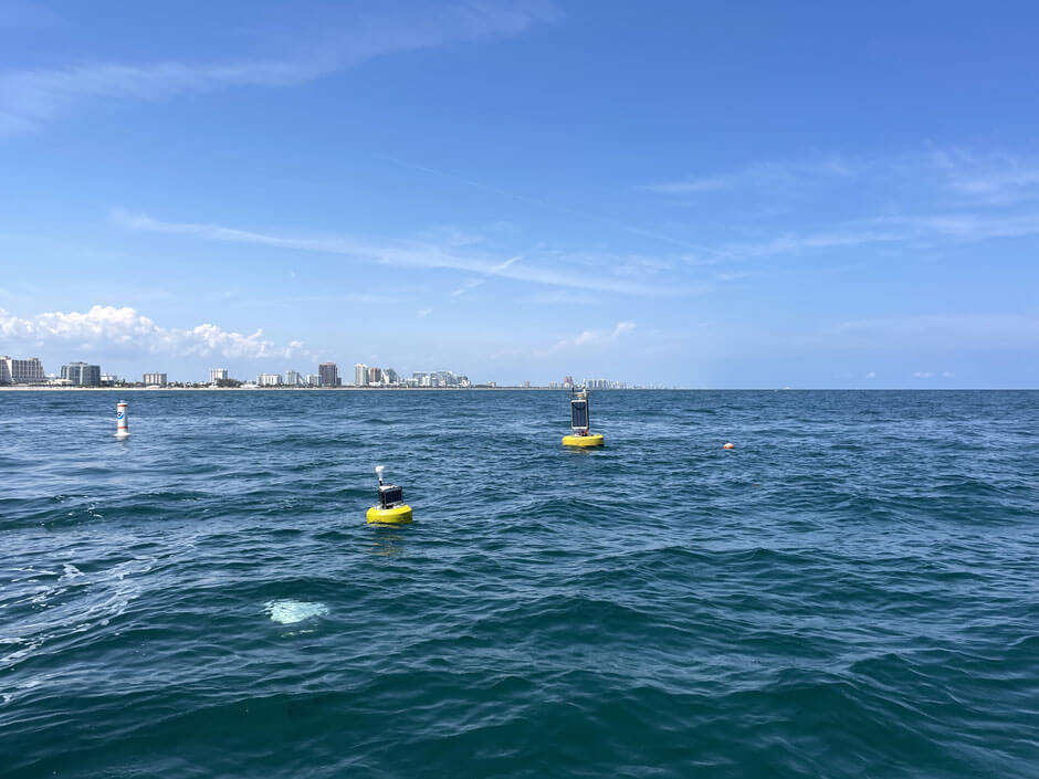
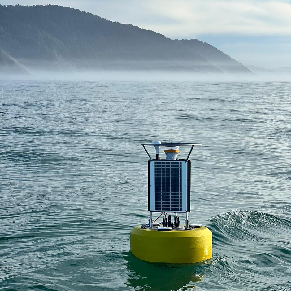
The CB-1250 buoy is a powerful platform suitable for sensor configurations with a high-power demand and large instruments that require special mounting. Despite being robust in size and construction, the CB-1250 maintains a relatively small footprint.
Data Logger
The X3 data logger mounts atop the CB-1250 solar tower, providing optimal range for integrated Wi-Fi, 4G LTE, or Iridium satellite telemetry. Pluggable, waterproof sensor ports simplify device connections and withstand harsh marine conditions.
Current Profiler
Preloaded scripts on the X3 data logger with detailed guides facilitate integration of common ADCP instruments, including the Nortek AWAC, Aquadopp, and Signature series profilers and the Aanderaa DCS and DCPS instruments.
Power
The (3) 71W solar panels and up to 112 A-Hr battery capacity of the CB-1250 provide ample power supply. It can support substantial sensor payloads with frequent data transmission, even in extreme geographic locations with limited sunlight.
Accessories
Custom buoy mounting brackets are available for many current profiler models. Common navigational accessories include an LED beacon for nighttime visibility, a radar reflector, and a GPS receiver. Sacrificial zinc anodes offer corrosion resistance in saltwater.
Need More?
Every current monitoring application is unique, and many call for additional measurement parameters. NexSens monitoring platforms come in many sizes and provide extreme flexibility by supporting various sensor types.
Additional Sensors
Current monitoring buoys can be expanded with instruments like weather stations, wave sensors, water quality sensors, and thermistor strings for more comprehensive measurement.
Tower-mounted meteorological instruments record a full suite of atmospheric parameters, such as air temperature, barometric pressure, solar radiation, and wind. Marine versions offer robust housings, compass-corrected wind direction, and integrated GPS.
Wave measurement is another common addition in sea state monitoring applications. The SVS-603HR inertial wave sensor is simple to mount and integrate. It provides statistical wave data, including significant wave height (Hs), wave period (Tp/DPD), direction, and more.
Below the surface, many water quality sensor types can be added for monitoring physical, chemical, and biological parameters like turbidity, pH, dissolved oxygen, algae, and nutrients. Multi-parameter sondes like the YSI EXO combine multiple sensors into a single instrument.
Multi-depth temperature profiling may be achieved using fixed-node TS210 and modular T-Node FR thermistor strings, which are customizable in node quantity and spacing. They must be deployed without interfering with ADCP measurements.
Alternate Buoy Sizes
While the CB-1250 is a flexible and powerful platform suitable for most current monitoring applications, some situations can benefit from smaller platforms, such as seasonal deployments, areas with ample sunlight year-round, or less frequent measurements.
The CB-650 and CB-950 maintain the same design concepts as the CB-1250, but in a smaller footprint with less buoyancy and battery capacity. In many cases, these are still suitable for high-frequency current monitoring and can represent cost savings.
The XB-200 is significantly smaller in terms of size and power capacity with its (3) 15W solar panels and maximum 56 A-hr battery capacity, but it is a versatile platform that can still handle a substantial payload.
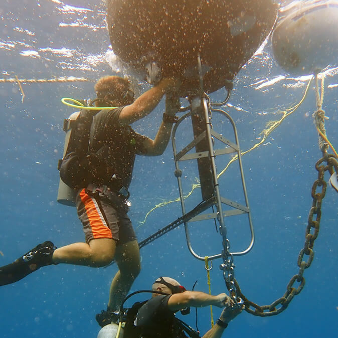
Mooring
Reliable performance in harsh environments depends on proper buoy mooring. Mooring components must not interfere with the acoustic beams of ADCP instruments for accurate current measurement.
Both single-point and multi-point moorings are feasible using the bottom eye nuts of the buoy hull. Single-point systems should be routed between ADCP beams, while multi-point can create clearance directly below the buoy.
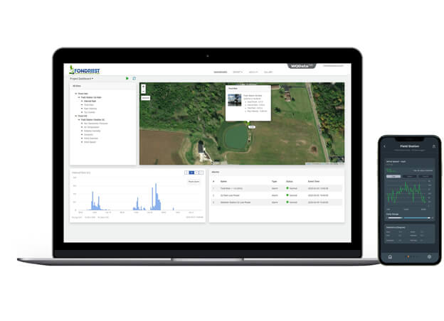
Real-Time Current Data
Near real-time current data is delivered to the WQData LIVE web datacenter from nearly any location worldwide via Wi-Fi, 4G LTE or Iridium satellite telemetry.
The free, basic WQData LIVE service provides secure data access and analysis tools, as well as data sharing through auto-reports, simple high/low Quick Alert notifications, and remote updates of data logger settings.
Subscription-based WQData LIVE tiers offer advanced reporting, alarming, and data sharing functions, including automated export, API, and Public Portal options.
Purchase in the USA
Visit our US distributor, Fondriest Environmental, to purchase online.
Purchase Internationally
Click the button below to find a local distributor.
Contact a NexSens Applications Scientist
Need help designing an Environmental IoT system? NexSens applications scientists will help you design the perfect monitoring system to meet field conditions and monitoring needs.
Related Videos


Case Studies
Sediment Monitoring in Port Everglades
To meet the demands of new large marine vessels, the Port Everglades in Florida needs to expand. The US Army Corps of Engineers is leading expansion efforts in the port with dredging planned to start in 2026 to deepen and widen the port to accommodate larger Panamax cargo ships and modern cruise liners. Challenges: Mitigating Environmental Impacts of Dredging The dredging project will displace a large amount of sediment into the water column, which could settle outside of the project area, burying benthic organisms like corals, and possibly carrying harmful particulates to other regions of the world. Dr. Enrique Montes, Associate Scientist of the University of Miami Cooperative Institute for Marine and Atmospheric Studies (CIMAS) affiliated to NOAA’s Atlantic Oceanographic and Meteorological Laboratory (AOML), is overseeing sediment monitoring off the channel of the Port.

Monitoring Weather, Wave, And Temperature Dynamics in Lake Erie’s Eastern Basin
For over a decade, Buffalo State University’s Great Lakes Center has maintained and operated a real-time monitoring buoy deployed off the coast of Dunkirk, New York, in Lake Erie's eastern basin. Funded by the Great Lakes Observing System (GLOS) and with field support from the NYSDEC Lake Erie Fisheries Research Unit, the buoy provides data to the local population and stakeholders as well as the larger Seagull database. Challenges: Public Data Reliance and Filling in Knowledge Gaps The purpose of the buoy is two-fold: Provide weather and wave data to the public in order to inform recreation and fishing operations. Contribute data to the multi-agency Seagull database. The Great Lakes Center operates one of only a few buoys in the eastern basin.
Sediment Monitoring During the Klamath Dam Removal
Leading up to the 21st century, the United States supported decades of dam construction in major waterways across the country. Many of these dams were hydroelectric facilities built in order to provide energy to nearby towns and cities. Unfortunately, these dams deteriorated the surrounding environment and harmed aquatic life. Many of these dams cut off migration routes for migratory fish like salmon and created reservoirs above the dam. These reservoirs are typically filled with still water that warms quickly over the summer, leading to declines in water quality and increases in algal blooms which, in turn, worsens the water quality further and impacts habitat suitability. For many dams, like the Klamath Dam in Washington, the cost of maintaining these facilities has outweighed any potential benefits they may have once provided. As a result, dams are being removed across the country in order to restore natural waterways and reopen critical pathways for fish migration. Challenge: Monitoring Dam Deconstruction